


Countries
Cities
Europe
Africa
Asia
North America
South America
Australia_Oceania
Calendar
Date
Moon
Int.Country Code +1 ccTLD .us Car: USA
 911
911  911
911  911
911
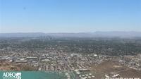
Current Time / Date in Phoenix
| City/Community: | Phoenix |
| Country/Region: | Arizona |
| Country/Territory: | USA |
| Local Time: | 8:27 or 8:27 am |
| Local Date: | Saturday, 22.April 2017 |
| Current difference from CEST: | -9 hours |
Current Weather in Casa Grande Arizona
in 1463 ft / 446 m Altitude
Last Updated on April 22, 7:56 AM MST

Temperature: 67 °F (19 °C) / Windchill: 19.6 °C
Wind speed: mph / 9.66 km/h
Rel.Humidity: 19 %
Pressure: 1012 mbar = hPa
© Weather Underground NOAA Weather Station
Distances
| Frankfurt, D | 9.062 km |
| Moscow, RUS | 9.791 km |
| Mumbai, IND | 13.164 km |
| Singapore | 14.747 km |
| Hong Kong, HK | 12.190 km |
| Shanghai, CN | 10.979 km |
| Beijing, CN | 10.602 km |
| Seoul, Korea | 10.179 km |
| Rio, Brazil | 9.530 km |
| Cape Town, ZA | 15.396 km |
| Sydney, AUS | 12.505 km |
| Auckland, NZ | 10.856 km |
| Honolulu, HI | 4.615 km |
| Los Angeles | 567 km |
| New York City | 3.457 km |
More Cities
Ajo, Ak-Chin Village, Amado, Apache Junction, Arizona City, Arizona Village, Ash Fork, Avondale, Avra Valley, Bagdad, Benson, Big Park, Bisbee, Bitter Springs, Black Canyon City, Blackwater, Bluewater, Bouse, Buckeye, Bullhead City, ...more

Airports close-by
Ernest A Love Fld/ Prescott PRC Altitude: 5045 miles
Phoenix Sky Harbor Intl PHX Altitude: 1135 miles
Luke Afb/ Phoenix LUF Altitude: 1085 miles
Phoenix-Mesa Gateway AZA Altitude: 1382 miles
Scottsdale Airport ZSY Altitude: 1519 miles
Marana Regional/ Tucson AVW Altitude: 2031 miles
Casa Grande Municipal Airport CGZ Altitude: 1464 miles
Buckeye Municipal Airport BXK Altitude: 1033 miles
Gila Bend Municipal Airport E63 Altitude: 789 miles
...more
Differences to World Time (UTC)
Current World Time(UTC): 15:27 or 3:27 pm
Current Date(UTC): Sat Apr 22, 2017
Saturday, 22.4.2017
Coordinates: 33° 0' N, 112° 0' W
Local Time Zone: Mountain Standard Time (MST)
Normal Difference from UTC: -7
Current Difference from UTC: -7
No Daylight Saving adjustments known.
Pictures from USA
Astronomical Data
Signs of the Zodiac: TAURUS (21.4.2017 - 20.5.2017)
Longitude: 33,0000°
Lattitude: -112,0000°
Coordinates: 33° 0' N, 112° 0' W
 | day before yesterday | yesterday | today | tomorrow | day after tomorrow |
| Sunrise | 05:49 | 05:48 | 05:47 | 05:46 | 05:45 |
| Sunset | 19:03 | 19:04 | 19:05 | 19:05 | 19:06 |
| Sun hours [hh:mm] | 13:14 | 13:16 | 13:18 | 13:19 | 13:21 |
| Twilights: | yesterday | today | tomorrow | ||
| Civilian Twilight | Begin | 05:22 | 05:21 | 05:20 | |
| Civilian Twilight | End | 19:30 | 19:31 | 19:31 | |
| Nautical Twilight | Begin | 04:52 | 04:50 | 04:49 | |
| Nautical Twilight | End | 20:00 | 20:01 | 20:02 | |
| Astronomical Twilight | Begin | 04:20 | 04:18 | 04:17 | |
| Astronomical Twilight | End | 20:32 | 20:33 | 20:34 |
Larger map
| April 2017 | ||||||
|---|---|---|---|---|---|---|
| Su | Mo | Tu | We | Th | Fr | Sa |
| 1 | 2 | |||||
| 3 | 4 | 5 | 6 | 7 | 8 | 9 |
| 10 | 11 | 12 | 13 | 14 | 15 | 16 |
| 17 | 18 | 19 | 20 | 21 | 22 | 23 |
| 24 | 25 | 26 | 27 | 28 | 29 | 30 |
| 31 |
Add this page to your Faves/Bookmarks E-Mail
All Rights reserved. © P.Wienzek 2008 - MMIX MMX MMXI MMXII MMXIII MMXIV MMXV MMXVI MMXVII V1.098a Generating this page took 1.6223 Seconds.
| These pages can be best viewed with Firefox. | 
|
