


Countries
Cities
Europe
Africa
Asia
North America
South America
Australia_Oceania
Calendar
Date
Moon
Int.Country Code +1 ccTLD .ca Car: CDN
 911
911  911
911  911
911

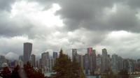
Current Time / Date in Vancouver
| City/Community: | Vancouver | |
| Country/Region: | British Columbia | |
| Country/Territory: | Canada | |
| Local Time: | 14:41 or 2:41 pm | |
| Local Date: | Thursday, 18.August 2016 | |
| Current difference from CEST: | -9 hours | |
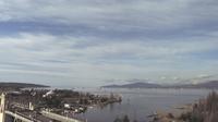
Current Weather in Eastsound Washington
in 30 ft / 9 m Altitude
Last Updated on August 18, 2:35 PM PDT

Temperature: 72 ┬░F (22 ┬░C) / Windchill: 22.5 ┬░C
Wind speed: mph / 27.36 km/h
Rel.Humidity: 57 %
Pressure: 1016 mbar = hPa
© Weather Underground NOAA Weather Station
Distances
| Frankfurt, D | 8.055 km |
| Moscow, RUS | 8.300 km |
| Mumbai, IND | 11.224 km |
| Singapore | 12.926 km |
| Hong Kong, HK | 10.316 km |
| Shanghai, CN | 9.097 km |
| Beijing, CN | 8.643 km |
| Seoul, Korea | 8.288 km |
| Rio, Brazil | 11.140 km |
| Cape Town, ZA | 16.343 km |
| Sydney, AUS | 12.439 km |
| Auckland, NZ | 11.306 km |
| Honolulu, HI | 4.325 km |
| Los Angeles | 1.718 km |
| New York City | 3.939 km |
Information of Vancouver
Vancouver (/v├”┼ŗ╦łku╦Év╔Ör/, or /v├”n╦łku╦Év╔Ör/), officially the City of Vancouver, is a coastal seaport city on the mainland of British Columbia, Canada, and the most populous city in the province. more...
Literature
Books about British Columbia
Books about Vancouver
Books about Time
Books about Astronomy
Currencies
Currency: Canadian Dollar (Abbr. CAD)
1.2829 CAD = 1 USD
1 CAD = 0.7795 USD
2016-08-18 Reference rate of ECB
More Cities
Abbotsford, Aldergrove, Armstrong, Ashcroft, Blind Bay, Burns Lake, Cache Creek, Campbell River, Castlegar, Chase, Chemainus, Chetwynd, Chilliwack, Courtenay, Cranbrook, Creston, Cultus Lake, Cumberland, Dallas, Dawson Creek, ...more
Airports close-by
Nanaimo YCD Altitude: 93 miles
Vancouver Intl YVR Altitude: 14 miles
Abbotsford YXX Altitude: 195 miles
Victoria Intl YYJ Altitude: 63 miles
Point Roberts Airpark 1RL  Altitude: 10 miles
Port Angeles Cgas NOW Altitude: 13 miles
Whidbey Island Nas NUW Altitude: 47 miles
Seattle Tacoma Intl SEA Altitude: 433 miles
Boeing Fld King Co Intl/ Seattle BFI Altitude: 21 miles
Bellingham Intl BLI Altitude: 170 miles
...more
Differences to World Time (UTC)
Current World Time(UTC): 21:41 or 9:41 pm
Current Date(UTC): Thu Aug 18, 2016
Thursday, 18.8.2016
Coordinates: 49┬░ 0' N, 123┬░ 0' W
Local Time Zone: Pacific Standard Time (PST)
Normal Difference from UTC: -8
Current Difference from UTC: -7
Summer-time starts on 2nd Sunday of March and ends on 1st Sunday of November, it's active from 13/3/2016 until 6/11/2016.
Pictures from Canada
Astronomical Data
Signs of the Zodiac: LEO (23.7.2016 - 23.8.2016)
Longitude: 49,0000┬░
Lattitude: -123,0000┬░
Coordinates: 49┬░ 0' N, 123┬░ 0' W
 | day before yesterday | yesterday | today | tomorrow | day after tomorrow |
| Sunrise | 05:05 | 05:07 | 05:08 | 05:10 | 05:11 |
| Sunset | 19:26 | 19:24 | 19:22 | 19:20 | 19:18 |
| Sun hours [hh:mm] | 14:21 | 14:17 | 14:14 | 14:10 | 14:07 |
| Twilights: | yesterday | today | tomorrow | ||
| Civilian Twilight | Begin | 04:32 | 04:34 | 04:35 | |
| Civilian Twilight | End | 19:58 | 19:56 | 19:54 | |
| Nautical Twilight | Begin | 03:49 | 03:51 | 03:53 | |
| Nautical Twilight | End | 20:42 | 20:39 | 20:37 | |
| Astronomical Twilight | Begin | 02:59 | 03:02 | 03:04 | |
| Astronomical Twilight | End | 21:31 | 21:28 | 21:26 |
Larger map
| August 2016 | ||||||
|---|---|---|---|---|---|---|
| Su | Mo | Tu | We | Th | Fr | Sa |
| 1 | 2 | 3 | 4 | 5 | 6 | 7 |
| 8 | 9 | 10 | 11 | 12 | 13 | 14 |
| 15 | 16 | 17 | 18 | 19 | 20 | 21 |
| 22 | 23 | 24 | 25 | 26 | 27 | 28 |
| 29 | 30 | 31 |
Add this page to your Faves/Bookmarks E-Mail
All Rights reserved. © P.Wienzek 2008 - MMIX MMX MMXI MMXII MMXIII MMXIV MMXV MMXVI V1.098a Generating this page took 1.8596 Seconds.
| These pages can be best viewed with Firefox. | 
|
