


Countries
Cities
Europe
Africa
Asia
North America
South America
Australia_Oceania
Calendar
Date
Moon
Int.Country Code +264 ccTLD .na Car: NAM

 1011
1011  2032270
  2032276
Current Time / Date in Oshakati
| City/Community: | Oshakati |
| Region: | Oshana |
| State/Region: | Namibia |
| Local Time: | 21:58 or 9:58 pm |
| Local Date: | Thursday, 18.August 2016 |
| Current difference from CEST: | -1 hour |
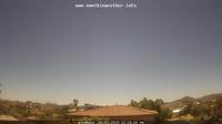
Current Weather in Ondjiva Ngjiva Pereira
in 3563 ft / 1086 m Altitude
Last Updated on August 18, 11:00 AM WAT

Temperature: 64 ┬░F (18 ┬░C) / Windchill: 18.1 ┬░C
Wind speed: mph / 12.87 km/h
Rel.Humidity: 29 %
Pressure: 1019 mbar = hPa
© Weather Underground NOAA Weather Station
Distances
| Frankfurt, D | 7.481 km |
| Moscow, RUS | 8.271 km |
| Mumbai, IND | 8.336 km |
| Singapore | 9.826 km |
| Hong Kong, HK | 11.604 km |
| Shanghai, CN | 12.465 km |
| Beijing, CN | 12.120 km |
| Seoul, Korea | 12.977 km |
| Rio, Brazil | 6.069 km |
| Cape Town, ZA | 1.804 km |
| Sydney, AUS | 12.751 km |
| Auckland, NZ | 13.719 km |
| Honolulu, HI | 19.061 km |
| Los Angeles | 14.983 km |
| New York City | 11.127 km |
Information of Oshakati
Oshakati is a town of 37,000 inhabitants in the Oshana Region of Namibia. It is the regional capital and was officially founded in July 1966. The city was used as a base of operations by the South African Defence Force (SADF) during the South African Border War and Namibian War of Independence. more...
More Cities
Katima Mulilo, Arandis, Henties Bay, Karibib, Omaruru, Otjimbingwe, Swakopmund, Usakos, Walvis Bay, Aranos, Maltah├Čhe, Mariental, Rehoboth, Bethanien, Karasburg, Keetmanshoop, L├╝deritz, Oranjemund, Warmbad, Rundu, ...more
Airports close-by
Xangongo XGN  Altitude: 3635 miles
Ondangwa Airport OND Altitude: 3599 miles
Ondjiva Pereira Airport VPE Altitude: 3566 miles
Okaukuejo Airport OKF Altitude: 3911 miles
...more
Phone Area Codes of Cities in Namibia
Keetmanshoop +(00) 264 631
L├╝deritz +(00) 264 6331
Oranjemund +(00) 264 6332
Oshakati +(00) 264 6751
Otjiwarongo +(00) 264 651
Swakopmund +(00) 264 641
Tsumeb +(00) 264 671
Walvis Bay +(00) 264 642
Windhoek +(00) 264 61
Windhoek Airport +(00) 264 626
more...
Differences to World Time (UTC)
Current World Time(UTC): 20:58 or 8:58 pm
Current Date(UTC): Thu Aug 18, 2016
Thursday, 18.8.2016
Coordinates: 17┬░ 46' S, 15┬░ 42' O
Local Time Zone: West Africa Time (WAT)
Normal Difference from UTC: +1
Current Difference from UTC: +1
Summer-time starts on 1st Monday of September and ends on 1st Sunday of April, it's active from 5/9/2016 until 2/4/2017.
Daylight Saving: not active
Pictures from Namibia
Astronomical Data in Oshakati
Signs of the Zodiac: LEO (23.7.2016 - 23.8.2016)
Longitude: -17,7800┬░
Lattitude: 15,7000┬░
Coordinates: 17┬░ 46' S, 15┬░ 42' O
 | day before yesterday | yesterday | today | tomorrow | day after tomorrow |
| Sunrise | 06:14 | 06:13 | 06:12 | 06:12 | 06:11 |
| Sunset | 17:48 | 17:48 | 17:48 | 17:49 | 17:49 |
| Sun hours [hh:mm] | 11:34 | 11:35 | 11:36 | 11:37 | 11:38 |
| Twilights: | yesterday | today | tomorrow | ||
| Civilian Twilight | Begin | 05:51 | 05:50 | 05:49 | |
| Civilian Twilight | End | 18:11 | 18:11 | 18:11 | |
| Nautical Twilight | Begin | 05:25 | 05:24 | 05:24 | |
| Nautical Twilight | End | 18:36 | 18:36 | 18:36 | |
| Astronomical Twilight | Begin | 04:59 | 04:59 | 04:58 | |
| Astronomical Twilight | End | 19:02 | 19:02 | 19:02 |
Larger map
| August 2016 | ||||||
|---|---|---|---|---|---|---|
| Su | Mo | Tu | We | Th | Fr | Sa |
| 1 | 2 | 3 | 4 | 5 | 6 | 7 |
| 8 | 9 | 10 | 11 | 12 | 13 | 14 |
| 15 | 16 | 17 | 18 | 19 | 20 | 21 |
| 22 | 23 | 24 | 25 | 26 | 27 | 28 |
| 29 | 30 | 31 |
Add this page to your Faves/Bookmarks E-Mail
All Rights reserved. © P.Wienzek 2008 - MMIX MMX MMXI MMXII MMXIII MMXIV MMXV MMXVI V1.098a Generating this page took 1.6748 Seconds.
| These pages can be best viewed with Firefox. | 
|
